- MAIN INDEX: Adolf Hitler Death and Survival: Legend, Myth and Reality
- Antarctic Haven
- Station 211
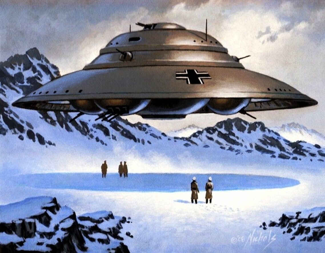
- Aryan UFOs and Antarctic Bases
- 'Third Reich - Operation UFO Nazi Base in Antarctica'
- Nazi Ufos and Secret Bases at the South Pole
- Hitler’s Antarctic base: the myth and the reality
- Nazi UFOs and Antarctica
Wendelle C. Stevens graduated from Lockheed Aircraft Maintenance & Repair School, Aviation Cadet School, and Fighter Pilot Advanced Training all as a very young 2nd lieutenant in the US Army Air corps. Then he attended the Test Pilot School where he learned to fly everything in the Air Corps inventory and a few Navy aircraft as well. Later he was assigned to the Ptarmigan Project, recording and analyzing visual and EMF emissions throughout the Arctic. Looking for influences to aircraft systems caused by UFOs, they recorded all disturbances. This effort was quite productive, and the data was hand carried to Washington, DC nightly. Stevens owns the UFO Photo Archives, the largest of its kind in private hands – over 3000 of them. He is a founding Director of the Annual International UFO Congress.
On 24 March 2000 at the IUFOC Convention Stevens spoke about Nazi flying saucers at the conference:
There were apparently nine secret bases in Germany working on anti-gravity vehicles. One involved BMW. Stevens even recalls seeing a map of the base locations in recovered German documents while in the AF, but it was shredded. After Hitler learned that he could not use these antigravity vehicles in the war, he launched two expeditions to the Antarctic led by Admiral Ritscher, one in 1938 and one in 1942 after the eastern front losses. The work on flying disks continued there.
Prior to World War II German scientists were obsessed with Antarctica. Far from finding a desolate wasteland covered with ice, the Germans discovered ice-free areas, warm water lakes and cavern systems.
The following passage refers to German efforts to claim a region of Antarctica after Norwegian expeditions in the 1920's and 30's:
"After these expeditions the Germans also got interested in Queen Maud land [or 'Neuschwabenland' as referred to by the Germans], and planned an expedition to declare it as theirs... Anyway, it is still lying there as a remote ice-shelf with lots of high mountains over the glacier. Truly a beautiful land.
"Queen Maud land is dominated by the giant shelf of ice, flowing slowly from King Haakon VII - plateau over the South Pole, down to the ocean. This area is called 'Fenriskjeften' after the mouth of the giant Devil-wolf in Norse mythology. According to this mythology Fenris' [the wolf] teeth were very sharp, and they would kill all people on Earth during Ragnarok - the end of the world".
Most of the mountains in Fenriskjeften have names with analogies to teeth, or to other parts of the Norse.
The use of wolf symbology is interesting as it touches upon a theme in Nazi symbology which used the wolf as a totem of the hunter-killer: Hitler's retreat in Berchtesgaden, Bavaria was nicknamed "Wolf's Lair" and the tactic used by German U-Boats to defeat convoys during the War was called "Wolfpack."
Germany also had Allies in South America and South Africa. Many Nazis fled to Argentina following the war and South Africa resembled a Nazi state as racial minorities [including Indians as well as blacks] were subjected to Apartheid.
 Hitler's dream was of a "Thousand-year Reich." Is this a thinly-veiled counterpart to Jesus' Millennial Kingdom? Allied pilots reported seeing "Foo Fighters" during the latter stages of the World War II.
These craft appeared and vanished at incredible speeds and created electrical and magnetic anomalies when close to Allied aircraft.
These craft are similar to "flying saucers" that were reported initially in 1947.
Nazi leaders were known for their obsession with the occult, including astrology and ancient relics. Remember the Indiana Jones movies that used Nazi quests for the holiest relics of the Judeo Christian faith? These movies are based on the occultic practices of Nazis.
Hitler's corpse was never found.
Recent reports of "opened KGB files" assert that Hitler's bones were kept and then destroyed by Soviet intelligence. But the current incarnation of Russia is a wolf in sheep's clothing and there is little faith in the KGB [or FSB, its "successor"] veracity.
UFO abductee Barney Hill [who in the 1960's was one of the first publicized abductees] claimed under hypnosis that one of his abductors "look[ed] like a German Nazi". Other abductees have claimed seeing Nazi-style decorations or hearing German or German-accented voices as part of their abduction experience.
Under "Operation Paperclip" Nazi scientists and Intelligence officers were integrated into the military, NASA, and the Intelligence community. Wernher von Braun is the most famous and is remembered for being the genius behind the Saturn rockets. The most infamous was Reinhard Gehlen, a Major General in the Nazi Abwehr or Intelligence agency.
Gehlen was sponsored by the Dulles brothers. John Foster Dulles was a founding member of the CFR and served as President Eisenhower’s Secretary of State; Allen was a president of the CFR, and was the Director of Central Intelligence - head of the CIA - when John F. Kennedy was assassinated.
Not only has the CIA been implicated in the assassination of JFK, Allen Dulles was a member of the Warren Commission - the investigative body JFK researchers argue was the government’s official cover-up of the conspiracy. German wealth [much of it looted from nations conquered during World War II] was spirited out of Germany.
U.S. Undersecretary of Commerce Stuart Eizenstadt reported the following concerning the Nazi Treasury:
"The evidence presented in this report is incontrovertible.
"....The Swiss National Bank and private Swiss bankers knew, as the War progressed, that the Reichsbank's [the German central bank] own coffers had been depleted, and that the Swiss were handling vast sums of looted gold".
-- Transcript: "Eizenstat Briefing on Looted Nazi Gold Report", United States Department of Commerce. 8 May 1997
"When World War II ended, and Europe was being overrun by the Allies, each country in charge of their sector of Europe engaged in looting. In our sector, we backed trucks up to the former production facilities and hauled off all the documents.
"Everyone else did the same thing".
"Some twelve years later the Australians discovered a 16mm film, a technical report, of the German V-7 research project. The V-7 weapons research project involved circular disk-shaped craft. Now, we knew about programs V-1 through V-4, but we had no previous idea about the V-7 program.
"The information in this documentary seemed to indicate that the Germans built their first operational disk sometime in the early 1940's in the first production facility in Prague. Then they proceeded to expand their design, development and research teams until by the time the Germans were being driven back into Germany, they had nine research facilities, all with projects under testing.
"They successfully evacuated eight of those facilities out of Germany, along with the scientists and the key people. The ninth facility was blown up. Now, this 16mm film showed some pictures of flying vehicles in operation.
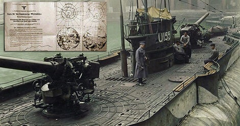
"We also knew through Intelligence, where I was working at the end of the war, that the Germans built eight very large cargo submarines, especially built, and they were all commissioned, launched and proceeded to disappear without a trace. To this day, we have no idea where they went.
"They are not on the bottom of the ocean or at any port we know of. It is a mystery, but the mystery might have been solved by this Australian documentary film, which shows large German cargo submarines in the Antarctic with ice flows all around them, and crews standing on deck waiting for tie-up at a quay. We have underground information that some of the research facilities in Germany were taken to a place called "New Schwabenland".

"Now, Germany was called 'Schwabenland' before it was called Germany. So, we are talking about 'New Germany', and it is located in an area at the South Pole formerly called Queen Maude Land".
Back around 1937, an international conference was convened under the League of Nations at the time to decide to restrict new claims to land in Antarctica.
At the time, everyone seemed to have a claim except Germany, who had not staked out a claim but only had some research going on down there. The whole thing was designed to keep Germany from making a land claim as the Nazi's were coming to power. The German claims, which were shown on German maps, were refused to be recognized.
A couple of years ago, "National Geographic" showed the German claim on a map for the first time.
In 1939, Hermann Göring financed an expedition to the Antarctic, including a submarine force, and they took construction and digging equipment down there and began excavating a tunnel complex.
this activity might have been going on since that time. and if that is the case, it could be a sizable complex today.
That may be where the big cargo submarines are.
"We believe that at least one or more of the disc research facilities were taken to Antarctica.
"We had information that one was taken to the Amazon, and that another was taken to the north coast of Norway, where there is a strong German population.
"They were taken into secretly maintained underground facilities.
"Before World War II, the Germans had military advisors all over South America, and when we got into the war we persuaded countries in South America to give up German advisors and accept American ones.
"Down there, they still prefer the Germans and have never liked us.
"It is quite possible that some of this material and some of these research facilities were de-centralized to South America as the German empire began to collapse.
"The big companies like I.G. Farben and the German subsidiary of General Electric opened large subsidiary plants in Rio and Sao Paulo in Brazil, and some of these new facilities became larger that they had been in Germany. So, there would have been support capability for disk research facilities. One has to wonder how much truth there really is to all of this".
It appears that some of the craft being seen today are nothing more than further developments of German disk technology. So, we may in fact be visited periodically by Germans.
One has to wonder how much being observed is man-made, and how much is truly extraterrestrial technology. Certainly there is some of both, but no one knows what the percentages are.
Secret Nazi military base discovered by Russian scientists in the Arctic
Scientists reported finding Bunkers, rusted bullets and other relics dating from the Second World War
Independent
21 October 2016
A secret Nazi military base in the Arctic has been discovered by Russian scientists.
Allied forces occupied most suitable sites for polar weather reports, so the Nazis landed a small group of observers on the island of Alexandra Land. The site, located 1,000km from the North Pole 0150 was constructed in 1942 a year after the invasion of Russia.
It was codenamed "Schatzgräber" or 'Treasure Hunter' by the Germans and was primarily used as a tactical weather station.
Supplies for the men at the remote post were dropped by air.
In 1944 all of the men at he base ate raw polar bear meat, which resulted in disease from roundworms living in the infected flesh.
A U-Boat had to evacuate the scientists posted there after infection ravaged their base.
The base was abandoned, It has been rediscovered 72 years later and more than 500 objects have been found, including a batch of well preserved documents, the "Daily Mail" reported.
The ruins of Bunkers, rusted bullets and other relics dating from the Second World War have been discovered at the site, many of which remain in a good condition having been preserved by the cold weather.
The island was vital during the Second World War as the meteorological reports it produced were essential for planning the movement of troops, submarines and ships.
The name given to the base has led some to believe it may have had another secret mission – with some specialists speculating that it might have been used for the pursuit of ancient relics.
Alexandra Land was a disputed territory for a number of years by a number of nations, including Norway, for its access to whaling territory, but is now part of the Russian Federation.
Russia is thought to be looking to build its own permanent military base there today.
Nazi Gold, Hitler’s DNA and the Lost Land of Thule
UFOs, Nazis, Atlantis, alien biological weapons, and the quest for the lost land of Thule all sound like a recent episode topics of Stargate SG-1. But these are just some of the stories associated with a sizable military project called 'Operation Highjump' that was conducted by the U.S. Navy in 1946 in Antarctica.
In 1943, German Navy Grand Admiral Karl Dönitz stated that the German submarine fleet had "built for the Führer an impregnable fortress at the other end of the world" in the region of Queen Maude’s Land, later renamed Neuschwabenland
According to German naval archives, two months after Germany surrendered to the Allies in April, 1945, the German submarine U-530 left the Port of Kiel bound for Antarctica. Once the submarine arrived at the South Pole, 16 members of its crew were ordered to construct an ice cave in the region of Neuschwabenland. When construction was complete, several boxes of relics from the Third Reich, including Hitler’s secret files, were supposedly stored there. The sub then entered the Argentinean port of Mar-del-Plata and surrendered to authorities. It is also rumored that the submarine U-977 delivered the remains of Adolf Hitler and Eva Braun to Neuschwabenland, for DNA cloning purposes. In August, 1945, one month and seven days after the surrender of U-530, U-977 also entered the waters of Mar-del-Plata and surrendered to authorities.
In 1946, U.S. Navy Admiral Marc A. Mitscher appointed Captain Richard H. Cruzen as commander of Operation Highjump, whose purported purpose was to map the frozen continent of Antarctica while looking for Uanium deposits in the region. But several conspiracy researchers assert that they were actually looking for the underground Nazi base that supposedly warehoused German treasure and Hitler’s DNA.
Cruzen had expeditionary experience in Antarctica, having served with Rear Admiral Richard Byrd on the U.S. Antarctic Service Expedition from 1939 to 1941. In 1947, Operation Highjump commenced as part of the U.S. Naval Antarctic Developments Project.
Mapping or Reconnaissance
Operation Highjump commenced as part of the U.S. Naval Antarctic Developments Project, organized by Secretary of the Navy James Forrestal. The task force consisted of over 40 ships, including two destroyer class vessels and the aircraft carrier the 'U.S.S. Philippine Sea', and a number of planes that were outfitted with a trimetricon [a secret spying camera], a magnetometer [to record any magnetic anomalies], and the recently developed jet-assist takeoff bottles [JATO] which helped with takeoffs from the short runway on an aircraft carrier or for takeoffs on hard surfaces such as ice.
According to government documents, members of Operation Highjump took over 70,000 aerial photographs of select inland areas of Antarctica. Yet most of the photographs were declared unusable for mapping purposes, due to the dearth of adequate ground control points [cartographers need these points when creating maps].
It has been long thought by researchers that the Navy’s mapping story was nothing more than a cover to shield the real operation, which was reconnaissance and recovery of Nazi/Alien hybrid technology.
It was also rumored that abandoned Nazi buildings and a downed Nazi plane was photographed, but this rumor has never been substantiated.
In 1947, Admiral Richard Byrd said, "the project was necessary for the USA to take defensive actions against enemy fighters which come from the polar regions".
Was he referring to potential Soviet aircraft or Nazi Luftwaffe attacking the States from Antarctica? He never clarified this cryptic statement, which has only served to fuel further conpiracy theories.
Shortly after Admiral Byrd’s press conference the Soviet naval journal, "Red Fleet", stated that "US measures in Antarctica testify that American military circles are seeking to subject the Polar Regions to control and create permanent bases for their armed forces." In another odd twist, the governments of New Zealand, Australia and Chile asked for their militaries to join the Operation Highjump expedition but were denied participation. Official government sources say the US was doing nothing more than mapping the frozen continent, though looking for uranium deposits seems to have been on the agenda as well. While others insist they were looking for the underground Nazi base that warehoused German Vril flying discs known as flugscheiben and Thule mercury-powered spaceship prototypes also known as Jenseitsflugmaschines.
In 1948, a second task force named Operation Windmill was also sent to take photographs of Neuschwabenland, again supposedly for mapping purposes. Although they apparently succeeded in their task, the government has yet to make these photos available to the public and no reason has ever been given for their nondisclosure. Some believe that the reason the photos have never been released is that this military operation was actually a reconnaissance and recovery mission.
In 1949, when James Forrestal began to suffer from a mental breakdown, he was sent to convalesce at Bethesda Naval Hospital. But when he began to discuss Operation Highjump with the hospital staff, talking wildly about UFOs, Atlantis, and an underground Nazi city, he was denied visitors, including his wife. Shortly afterwards, he fell out of his hospital window to his death. The official report said that he committed suicide but persistent rumors say that he was murdered by government agents to keep him from talking further about what was really found in the Antarctica wilderness during Operation Highjump.
The truth of the matter may never come to light, but what is known is that several U.S. military personnel surprisingly lost their lives during Operation Highjump; a supposed mapping operation that should have been an entirely safe endeavor. Also, multiple planes were downed during the operation, including the "George One" which, according to Naval documents, mysteriously "just blew up" over the ice during its initial flight in Antarctica.
Beyond the legends of Nazi gold and Hitler’s DNA, could the Germans have been hiding advanced technology, or at least the blueprints for such, in Antarctica? Could the Nazis have hidden highly advanced foo fighters or even a nuclear bomb there? According to British Intelligence, we know that advanced, stealth foo fighters and Vril flying saucer-shaped craft were on the drawing board at the German Institute for Aerial Development. We also know that Austrian Viktor Schauberger discovered that physics operates with a dual principle of centripetence and centrifugence, also known as vortex dynamics. One of the experiments headed up by Schauberger included the apparent levitating of aircraft by the use of a water and hydrogen mixture coupled with vortex energy. This could have been a foo fighter prototype. According to records seized by Allies from the archives of the German High Command, the Nazis were also developing a series of A9 and A10 nuclear missiles with the goal of destroying New York City and Washington, DC. It was said that Schauberger’s air ships were the vehicle of choice for the delivery of these bombs. Though we know that such missiles were in the early development stages, blueprints for such weapons were never found. What is known is that these blueprints never fell into British or Russian hands. However, several of Schauberger’s prototype repulsine vortex machines were confiscated both the US and Russian military. After the war, Schauberger lived in the US and was rumored to be employed by the US government working as a consultant on a top secret UFO project in Texas, though his whereabouts also were also placed at Area 51, in the New Mexico desert.
Another rumor associated with Nazi involvement in Antarctica and Operation Highjump is that Antarctica was the lost Aryan homeland of Thule. While Antarctica has been linked to the lost continent of Atlantis, the linkage to Thule is less apparent. Thule [also known as Thula, Thyle, Thila, Tila, Tyle, or Tylen, among other cognates] was first written about by the Greek explorer Pytheas after his travels between 330 BC and 320 BC. In 150 AD, Greek writer Antonius Diogenes wrote "The Wonders Beyond Thule", a most likely fictional account of adventurer’s tales. While of literary interest, this work did little to reveal any secrets about Thule. Based upon writings by the Roman poet Virgil and by Roman Historian Pliny, scholars traditionally believed that Thule was most likely a reference to either Iceland, Greenland or Scandinavia. In medieval geographies Thule was referred to as distant place located beyond the "borders of the known world".
Nazi mystics believed in historical Thule [also referred to as Hyperborea] as the ancient origin of the Aryan race. The Thule Society or Thule-Gesellschaft was founded in 1918 by German occultist Rudolf von Sebottendorff to pursue research on Thule. The Nazis utilized the Thule Society as a focus point for all sorts of "black ops" projects. This is where the basis for Antarctica not only being a secret UFO base, but the lost land of Thule first originated. Legends and urban myths about Nazi-driven Thule Society exploits have persisted into the 21st century.
Just what was the US military doing in Antarctica in 1946 and 1947? Were they searching for uranium deposits or were they engaging remnant Nazi fighters in a battle for hidden alien/Nazi technology? Did the Nazis truly bury military secrets in the Antarctic or hide vast amounts of gold there in hopes of funding a future effort to resurrect the Fourth Reich. Or did they, as some claim, discover the lost land of Atlantis or Thule?
We may never know for sure but in 2001, the U.S. National Geospatial-Intelligence Agency and the Support Office for Aerogeophysical Research confirmed the existence of a magnetic anomaly on the eastside shore of Lake Vostok in Antarctica, consistent with a man-made construct. Could this anomaly be part of an underground Nazi base that U.S. agents searched for during Operation Highjump?
Currently several organizations including U.S. National Geospatial-Intelligence Agency, the Support Office for Aerogeophysical Research (SOAR), the Earth Observatory of Columbia University and the British Antarctic Survey are performing research in Antarctica. In fact, the British Antarctic Survey is researching the magnetic anomaly, as well as other Antarctic phenomenon including the recently discovered subglacial lake, as part of the multinational task force mission known as the Antarctic Magnetic Anomaly Project. This project also involves research teams from Ohio State University, the Scientific Committee on Antarctic Research [SCAR], NASA and various members of the International Association of Geomagnetism and Aeronomy as well as the International Union of Geodesy and Geophysics. The Russian Arctic and Antarctic Research Institute [AARI] is also currently performing magnetic and subglacial like research projects in Antarctica.
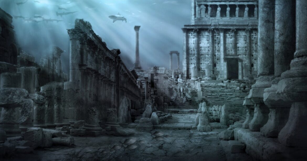
Something has indeed been discovered in Antarctica. One of the questions that begs to be asked is did the Nazis find, whatever it is, first? Did we send our military to Antarctica in 1946 to seize this discovery, thus laying claim to it before any other government could do so? In his groundbreaking bestseller "Map of the Ancient Sea Kings", Charles Hapgood (1904-1982), History Professor at Springfield College in Springfield, Massachusetts, first put forth the theory that Atlantis resided in Antarctica and was destroyed by crustal displacement. In his bestseller, "When The Sky Fell: In Search of Atlantis", Rand Flem-Ath furthered this idea that under the ice of Antarctica exists the remains of Atlantis. Could they be right?
Additional Notes
In 1999, with assistance of the Freedom of Information Act, I requested and was able to obtain a sizable file on Operation Highjump. Nothing too startling existed in the dossier but it did contain declassified military documents, ship manifests, official communiqués, etc. But in 2005 when I sent in a second request for information on Operation Highjump I received much less documentation than before. I guess in a post 9/11 world, information has become more restricted than before, though with this particular project it’s difficult to imagine why that would be the case.
One scientific discovery that was made during Operation Highjump was quite possibly the first evidence of global warming. Researchers on the expedition discovered that a region of Antarctic glacier had melted and came to the conclusion that it was due to the negative impact of pollution on the environment.
More recently, in October 2006, the Scripps Institute of Oceanography reported that they discovered several previously unknown lakes of water underneath the vast ice sheet of Antarctica. These lakes lie beneath 2,300 feet of compressed snow and ice. To detect the subglacial lakes the Scripps Institute used data from NASA’s ICESat, which sends laser pulses down from space to the Antarctic surface and back, much as sonar uses sound pulses to determine underwater features. The satellite detected descended anomalies in the surface that moved around as the hidden lakes continuously drain and fill beneath the surface glaciers. The Scripps Institute made observations from 2003 through 2006 of the Whillans and Mercer Ice Streams, two of the fast-moving glaciers that carry ice from the Antarctic interior to the floating ice sheet that covers parts of the Ross Sea. This project was conducted as part of a global warming assessment. This melting and draining was not because of global warming but of natural processes. Their report made no mention of the magnetic anomaly.
Michael Lohr is a professional journalist, outdoorsman, music critic, treasure hunter and adventurer. His writing has appeared in such diverse magazines as "Rolling Stone", "Esquire", "The Economist", "National Geographic Adventure", "Cowboys & Indians" and "Men’s Journal", to name a few.
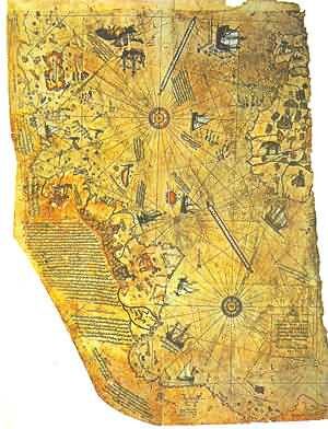
Piri Reis Map
Introduction
In 1929, during renovations of the old Imperial Palace in what is now Istanbul [formerly Constantinople], a painted, parchment map, drawn on a gazelle skin.was found, dated in the month of Muharrem, in the Moslem year 919 [A.D. 1513], and signed by an admiral of the Turkish navy, Piri Ibn Haji Memmed, known as Piri Re'is.
Research showed that it was a genuine document drawn in 1513 by Piri Reis in the sixteenth century.His passion was cartography.
His high rank within the Turkish navy allowed him to have a privileged access to the Imperial Library of Constantinople.
Piri Re'is own commentary indicates that some of his source maps were from the time of Alexander the Great [332 B.C.].
The Controversy
The Piri Reis map shows the western coast of Africa, the eastern coast of South America, and the northern coast of Antarctica. The northern coastline of Antarctica is perfectly detailed.
The most puzzling however is not so much how Piri Reis managed to draw such an accurate map of the Antarctic region 300 years before it was discovered, but that the map shows the coastline under the ice.
Geological evidence confirms that the latest date Queen Maud Land could have been charted in an ice-free state is 4000 BC.
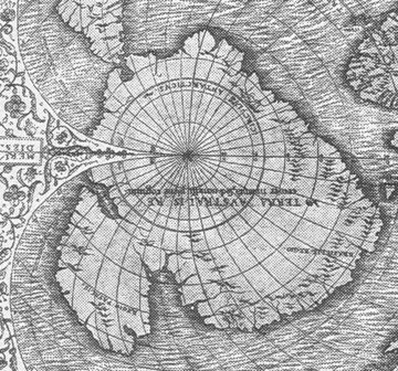
On 6 July 1960 the U. S. Air Force responded to Prof. Charles H. Hapgood of Keene College, specifically to his request for an evaluation of the ancient Piri Reis Map
6 July 1960
Subject: Admiral Piri Reis Map
TO: Prof. Charles H. Hapgood
Keenee College
Keene, New Hampshire
ear Professor Hapgood,
Your request of evaluation of certain unusual features of the Piri Reis map of 1513 by this organization has been reviewed.
The claim that the lower part of the map portrays the Princess Martha Coast of Queen Maud Land, Antarctic, and the Palmer Peninsular, is reasonable. We find that this is the most logical and in all probability the correct interpretation of the map.
The geographical detail shown in the lower part of the map agrees very remarkably with the results of the seismic profile made across the top of the ice-cap by the Swedish-British Antarctic Expedition of 1949.
This indicates the coastline had been mapped before it was covered by the ice-cap.
The ice-cap in this region is now about a mile thick.
We have no idea how the data on this map can be reconciled with the supposed state of geographical knowledge in 1513.
Harold Z. Ohlmeyer Lt. Colonel, USAF Commander
The official science has been saying all along that the ice-cap which covers the Antarctic is millions of years old.
The Piri Reis map shows that the northern part of that continent has been mapped before the ice did cover it. That should make one think it has been mapped million years ago, but that's impossible since mankind did not exist at that time.
Further and more accurate studies have proven that the last period of ice-free condition in the Antarctic ended about 6000 years ago.
There are still doubts about the beginning of this ice-free period, which has been put by different researchers everything between year 13000 and 9000 BC.
The question is: Who mapped the Queen Maud Land of Antarctic 6000 years ago? Which unknown civilization had the technology or the need to do that?
To draw his map, Piri Reis used several different sources, collected here and there along his journeys. He himself has written notes on the map that give us a picture of the work he had been doing on the map. He says he had been not responsible for the original surveying and cartography. His role was merely that of a compiler who used a large number of source-maps. He says then that some of the source-maps had been drawn by contemporary sailors, while others were instead charts of great antiquity, dating back up to the 4th century BC or earlier.
Dr. Charles Hapgood, in his book "Maps of the Ancient Sea Kings" [Turnstone books, London 1979, preface], said that:
"It appears that accurate information has been passed down from people to people. It appears that the charts must have originated with a people unknown and they were passed on, perhaps by the Minoans and the Phoenicians, who were, for a thousand years and more, the greatest sailors of the ancient world. We have evidence that they were collected and studied in the great library of Alexandria".
Piri Reis had probably come into possession of charts once located in the Library of Alexandria, the well-known most important library of the ancient times".
According to Hapgood's reconstruction, copies of these documents and some of the original source charts were transferred to other centers of learning, and among them to Constantinople. Then in 1204, year of the fourth Crusade, when the Venetians entered Constantinople, those maps begun to circulate among the European sailors.
Most of these maps -Hapgood goes on- were of the Mediterranean and the Black sea. But maps of other areas survived. These included maps of the Americas and maps of the Arctic and Antarctic Oceans.
It becomes clear that the ancient voyagers travelled from pole to pole.
Unbelievable as it may appear, the evidence nevertheless indicates that some ancient people explored Antarctic when its coasts were free of ice. It is clear too, that they had an instrument of navigation for accurately determining the longitudes that was far superior to anything possessed by the peoples of ancient, medieval or modern times until the second half of the 18th century.
In 1953, a Turkish naval officer sent the Piri Reis map to the U.S. Navy Hydrographic Bureau. To evaluate it, M.I. Walters, the Chief Engineer of the Bureau, called for help Arlington H. Mallery, an authority on ancient maps, who had previously worked with him.
After a long study, Mallery discovered the projection method used. To check out the accuracy of the map, he made a grid and transferred the Piri Reis map onto a globe: the map was totally accurate. He stated that the only way to draw map of such accuracy was by aerial surveying: but who, 6000 years ago, could have used airplanes to map the earth??
The Hydrographic Office couldn't believe what they saw: they were even able to correct some errors in the present days maps!!
The precision on determining the longitudinal coordinates, on the other hand, shows that to draw the map it was necessary to use the spheroid trigonometry, a process supposedly not known until the middle of 18th century.
The way the Piri Reis map shows the Queen Maud land, its coastlines, its rivers, mountain ranges, plateaus, deserts, bays, has been confirmed by a British-Swedish expedition to Antarctic [as said by Olhmeyer in his letter to Hapggod]; the researchers, using sonar and seismic soundings, indicated that those bays and rivers etc, were underneath the ice-cap, which was about one mile thick.
Charles Hapggod, in 1953, wrote a book called "Earth's shifting crust: a key to some basic problems of earth science", where he made up a theory to explain how Antarctic had been ice-free until year 4000 BC.
The theory summing up is as follows:
"The reason Antarctic was ice-free, and therefore much warmer, it is to be found in the fact that, at one time, its location wasn't the south pole. It was located approximately 2000 miles further north. Hapgood says this "would have put it outside the Antarctic Circle in a temperate or cold temperate climate.
"The reason why the continent moved down to its present location has to be found in a mechanism called "earth-crust-displacement". This mechanism, not to be confused with the plate-tectonics or the continental drift, is one whereby the lithosphere, the whole outer crust of the earth "may be displaced at times, moving over the soft inner body, much as the skin of an orange, if it were loose, might shift over the inner part of the orange all in one piece".
This theory was sent to Albert Einstein, which answered to Hapgood in very enthusiastic terms. Though geologists did not seem to accept Hapgood's theory, Einstein seemed to be as much open as Hapgood, saying:
"In a polar region there is a continual deposition of ice, which is not symmetrically distributed about the pole. The earth's rotation acts on these unsymmetrically deposited masses, and produces a centrifugal momentum that is transmitted to the rigid crust of the earth. The constantly increasing centrifugal momentum produced in this way will, when it has reached a certain point, produce a movement of the earth's crust over the rest of the earth's body..."
-- Albert Einstein's foreword to "Earth's shifting crust"
In fact Piri Reis himself admitted he based his map on way older charts; and those older charts had been used as sources by others who have drawn different maps still of great precision.
Impressive is the "Dulcert's Portolano", year 1339, where the latitude of Europe and North Africa is perfect, and the longitudinal co-ordinates of the Mediterranean and of the Black sea are approximated to half a degree.
An even more amazing chart is the "Zeno's chart", year 1380. It shows a big area in the north, going up till the Greenland; Its precision is flabbergasting. "It's impossible" says Hapgood "that someone in the fourteenth century could have found the exact latitudes of these places, not to mention the precision of the longitudes..."
Another amazing chart is the one drawn by the Turkish Hadji Ahmed, year 1559, in which he shows a land stripe, about 1600 Km. wide, that joins Alaska and Siberia. Such a natural bridge has been then covered by the water due to the end of the glacial period, which rose up the sea level.
Oronteus Fineus was another one who drew a map of incredible precision. He too represented the Antarctic with no ice-cap.
in his book, "Fingerprints of the Gods", Graham Hancock presents strong evidence that Antarctica was charted long ago by unknown people, when temperatures were much warmer.
He cites a number of old maps, such as the one drawn by Oronteus Finaeus in 1531, reproduced here. Experts examined the original and its age was verified. It was made in the 1500s--three centuries before Antarctica was allegedly even sighted, much less documented.
The map is startlingly accurate, depicting ice-free mountain ranges, a South Pole that's just about dead on and the Ross Sea as it would look without the ice shelf.
You can even see Ross Island.
How could someone draw such a map more than 200 years before Capt. James Cook even sailed south of the Antarctic Circle?
Hancock's answer is that it was actually mapped long ago, perhaps thousands of years earlier, and Finaeus merely copied those ancient sources.
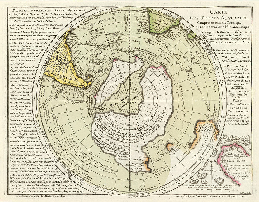
There are maps showing Antarctica as two separated islands, as it was confirmed by a polar French expedition in 1738, which found out that there is an ice cap quite thick joining what it is actually two islands.
When human beings were supposed to live in a primitive manner, someone "put on paper" the whole geography of the earth. And this common knowledge somehow fell into pieces, then gathered here and there by several people, who had lost though the knowledge, and just copied what they could find in libraries, bazaars, markets and about all kind of places.
Hapggod made a disclosure which amazingly lead further on this road: he found out a cartographic document copied by an older source carved on a rock column, China, year 1137. It showed the same high level of technology of the other western charts, the same grid method, the same use of spheroid trigonometry. It has so many common points with the western ones that it makes think more than reasonably, that there had to be a common source: could it be a lost civilization, maybe the same one which has been chased by thousands years so far.
Summary
The Piri Re'is map is often exhibited in cases seeking to prove that civilization was once advanced and that, through some unknown event or events, we are only now gaining any understanding of this mysterious cultural decline. The earliest known civilization, the Sumerians in Mesopotamia, appear out of nowhere around 4,000 B.C. but have no nautical or maritime cultural heritage. They do, however, speak reverently of ancestral people who were like the "gods" and were known as the Nefilim.
Here is a summary of some of the most unusual findings about the map:
Scrutiny of the map shows that the makers knew the accurate circumference of the Earth to within 50 miles.
The coastline and island that are shown in Antarctica must have been navigated at some period prior to 4,000 B.C. when these areas were free of ice from the last Ice Age.
The map is thought to be one of the earliest "world maps" to show the Americas
Early scholars suggested that it showed accurate latitudes of the South American and African coastlines - only 21 years after the voyages of Columbus! [And remember, Columbus did NOT discover North America - only the Caribbean].
Writing in Piri Re'is own hand described how he had made the map from a collection of ancient maps, supplemented by charts that were drawn by Columbus himself. This suggests that these ancient maps were available to Columbus and could have been the basis of his expedition.
The "center" of the source map projected from coordinates in what is now Alexandria - the center of culture and home of the world's oldest and largest library until its destruction by Christian invaders.
New Swabia [Neuschwabenland] is an area of Antarctica between 20°E and 10°W in Queen Maud Land. It was explored by the German Antarctic Expedition which discovered ice-free areas with warm fresh-water lakes and vegetation.
While it is widely accepted that the Nazis were defeated with the German Government's formal surrender in 1945, this is only partly true. The media is largely controlled by the Rothschild banking dynasty, and has promoted a false narrative concerning the events of WW2.
Hitler's body was never recovered, and no Nazi party member ever signed any documents of surrender. That is why, after the Allies claimed unconditional victory, Secretary of Defense James Forrestal sent a naval task force, called "Operation Highjump", to Antarctica, including Admiral Chester Nimitz, Admiral Richard Cruzen and Admiral Richard Byrd. Over 4,700 military troops from the U.S., Britain and Australia, consisting of three Naval battle groups departed on 2 December 1946.
The US military and intelligence were apparently trying to locate the immense underground facility constructed by the Germans, before, during and immediately after the Second World War, Base-211, that was likely used to further their research and successful development of advanced propulsion technology, based on free energy.
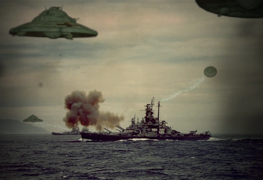 According to first hand testimonials from crew members participating in Operation Highjump, including an interview given by Admiral Byrd himself, the Antarctic Nazis developed their saucer-shaped discs far in advance of anything possessed by the U.S. They swiftly defeated the massive "post WW2" Allied military attack. Another motive associated with Nazi involvement in Antarctica is that it was rumored to be the entrance to the lost Aryan homeland of Thule. While Antarctica has been linked to the
More recently, in October 2006, the Scripps Institute of Oceanography reported that they discovered several previously unknown lakes of water underneath the vast ice sheet of Antarctica. These lakes lie beneath 2,300 feet of compressed snow and ice.
Could this anomaly be part of an underground Nazi base that U.S. agents searched for during Operation Highjump?
Something has indeed been discovered in Antarctica. One of the questions that begs to be asked is did the Nazis find, whatever it is, first?
Documents obtained by the obtained by the KGB at the close of WW2 recently surfaced which shows a Top Secret 1944 map from the Third Reich detailing not only the direct passageway used by German U-Boats to access underground polar caverns, but also a complete map of both hemispheres of the inner realm of Aghartha, the mythical name of the inhabited subterranean world.
lost continent of Atlantis, the linkage to Thule is less apparent.
Thule [also known as Thula, Thyle, Thila, Tila, Tyle, or Tylen, among other cognates] was first written about by the Greek explorer Pytheas after his travels between 330 BC and 320 BC.
In 150 AD, Greek writer Antonius Diogenes wrote "The Wonders Beyond Thule". While of literary interest, this work did little to reveal any secrets about Thule.
In medieval geographies Thule was referred to as distant place located beyond the "borders of the known world". Occult mystics believe in historical Thule [also referred to as Hyperborea] as the ancient origin of the Aryan race.
Just what was the US military doing in Antarctica in 1946 and 1947? Were they on a routine mapping mission or were they engaging remnant Nazi fighters with advanced alternative technology?
Did the Nazis truly build a military base in the Antarctic or hide vast amounts of gold there in hopes of funding a future effort to resurrect the Fourth Reich? Or did they, as some claim, discover the lost land of Atlantis or Thule?
We may never know for sure, but in 2001 the U.S. National Geospatial-Intelligence Agency and the Support Office for Aero-geophysical Research confirmed the existence of a magnetic anomaly on the eastside shore of Lake Vostok in Antarctica, consistent with a man-made construct.
More recently, in October 2006, the Scripps Institute of Oceanography reported that they discovered several previously unknown lakes of water underneath the vast ice sheet of Antarctica.
These lakes lie beneath 2,300 feet of compressed snow and ice.
Could this anomaly be part of an underground Nazi base that U.S. agents searched for during Operation Highjump?
Something has indeed been discovered in Antarctica. One of the questions that begs to be asked is did the Nazis find, whatever it is, first?
Documents obtained by the obtained by the KGB at the close of WW2 recently surfaced which shows a Top Secret 1944 map from the Third Reich detailing not only the direct passageway used by German U-Boats to access underground polar caverns, but also a complete map of both hemispheres of the inner realm of Aghartha, the mythical name of the inhabited subterranean world.
.In his groundbreaking bestseller "Map of the Ancient Sea Kings", Charles Hapgood, History Professor at Springfield College in Springfield, Massachusetts, first put forth the theory that Atlantis resided in Antarctica and was destroyed by crustal displacement.
In their bestseller, "When The Sky Fell: In Search of Atlantis", Rand and Rose Flem furthered this idea that under the ice of Antarctica exists the remains of Atlantis
The possibility that the earth contains massive subterranean caverns, or is at least partially hollow, that these regions are accessible through passages at the poles, and that ancient secret breakaway civilizations flourish within them, has renewed people’s interest in a subject still considered by the media to be taboo. Could the Earth really have entire inhabited cities underground that we are unaware of on the surface? Where are the entrances to inner earth, and which races live on the inside?
The idea that our planet consists of a hollow, or honeycombed, interior is not new. Some of the oldest cultures speak of civilizations inside of vast cavern-cities, within the bowels of the earth. According to certain Buddhist and Hindu traditions, secret tunnels connect Tibet with a subterranean paradise, and they call this legendary underworld Agartha. In India, this underground oasis is best known by its Sanskrit name, Shambhala, thought to mean "place of tranquility". Mythologies throughout the world, from South America to the Arctic, describe numerous entrances to these fabled inner kingdoms. Many occult organizations, esoteric authors, and secret societies concur with these myths and legends of subterranean inhabitants, who are the remnants of antediluvian civilizations, which sought refuge in hollow caverns inside the earth.
Assuming that the myths are true, and the Earth is partially hollow, how could life survive underground? How would organisms receive the ventilation required to breathe miles below the surface? What would provide the light needed to see, or to cause the photosynthesis necessary for the plant life that allegedly exists in these inner worlds? Are there any known sources of sustenance available that could provide for a large human population?
Numerous endevours have been undertaken to access the interior of the earth. Polar expeditions and battles, such as Operation Highjump, still remain largely classified, and have been shrouded in secrecy for decades, but scientific revelations validating the rumors surrounding these covert events, and their implications, are finally being exposed to daylight.
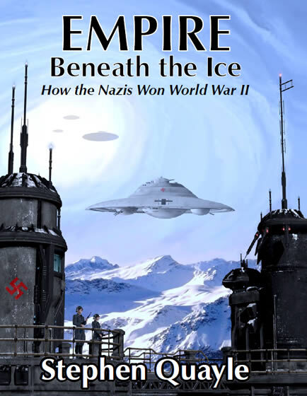
Hitler had A Secret Underground Base In Antarctica
The truth about history has been hidden…In "Empire Beneath the Ice", author Stephen Quayle reveals why most of what you learned about World War II and the defeat of Nazi Germany is wrong.
You’ll discover:
Why they suppressed evidence proving Adolf Hitler did not die before Germany surrendered during WWII, and how he eluded capture.
How Nazi SS members, scientists, and soldiers escaped with Hitler to create colonies in other parts of the world to continue their monstrous research.
Why in 1947 Admiral Richard E. Byrd warned that the US should adopt measures to protect against an invasion by hi-tech aircraft coming from the polar regions, adding:
"The time has ended when we were able to take refuge in our isolation and rely on the certainty that the distances, the oceans, and the poles were a guarantee of safety".
How, using advanced technology, Nazi saucers defeated the US military — long after WWII was supposedly over.
Why the US space program was mostly a sham, and why the "UFOs" that started appearing around the world in the late 1940s were [and still are] most likely flown by Nazi pilots.